It’s not just a fall destination, although I’ve seen plenty of social media posts with photos of the beautiful landscape when the tree leaves are changing colors.
My family camped at Lost Maples State Natural Area during Memorial Day weekend, and it quickly became one of our favorite places.
All three of us had a fantastic time during our two nights and part of three days trip hiking the trails, taking in the scenery and drinking some of the purest spring water we’ve had (yes, we filtered it first, for anyone who might be wondering). We already have plans to return in November to see the fall foliage.

Lost Maples has 28 RV sites with water and electricity, which would allow for day hikes on loop trails, or a quick trip to wade / swim in the pond at the day use area (pictured above). For those interested in primitive camping, there are seven camps available. Three of them (camps B, E and F) are up on a ridge / plateau, and the other four (A, D, and H) are in the lower portions of the park. Camp G, located on the West Loop Trail, appears to be on a ridge / plateau based on the trail map contour lines, but it was the only one we didn’t hike to. While there are obvious locations where people camp regularly within each campground, there are no formal sites and it is a dispersed camping approach once you’re in the formal camp boundaries.
A park map is available here, and a trail map is available here.

Located a few miles north of Vanderpool, Texas, and around 70 miles (“as the crow flies”) northwest of San Antonio, if you shared a photo from one of the scenic overlooks, it’s doubtful that someone who hadn’t been there would guess it is Texas.
If you’re like us and wondered what the difference is between a state natural area and state park, a 2015 TPWD Magazine article offered the following explanation: “State parks … are areas of natural or scenic character developed to provide recreational opportunities. State natural areas … preserve areas with outstanding natural attributes; their primary emphasis is on protecting those resources, not on recreation.”

The Sabinal River runs along the eastern portion of the natural area, with the East Trail crossing the river multiple times. A helpful tip: either plan some time to dry out your socks and shoes after finishing the East Trail or bring some hiking sandals, crocs or something similar to hike the East Trail up to primitive campsite A where you can switch to your regular hiking footwear. (NOV. 2021 UPDATE: We spent three nights at Lost Maples over Veterans Day weekend, finding that the significant water over the trails we encountered in May was an anomaly. We hiked the East trail without any need for water shoes. See here for details on this Nov. 2021 trip and see here for details on a new year’s weekend 2022-2023 trip).

Starting at the trailhead for the East Trail, we made our way to “Monkey Rock.” After a snack break, we continued on the East Trail to the Grotto, a natural cave formation that is one of a few we saw in the park, but is the only one noted on the trail map.


Shortly after the Grotto, the trail begins the first significant ascent, bringing you up to a ridge / plateau with multiple locations (including two official scenic overlooks) to view the valleys below.

We reached primitive campsite B around 3 p.m., scouted locations, found a spot with a decent view and pitched our tent. The photo on the right below was post-dinner when there was some shade but it had not quite reached our tent. We skipped other site options with shade in favor of a better view — particularly of the sunset.

Since it was a bit warm with the afternoon sun, we then headed down to the day use area for the rest of the afternoon. This involves a steep descent down into the valley where there is a large pond, a composting toilet and several places where you can collect and filter water.

After eating dinner at the day use area, we hiked back up the steep section of the East Trail to our campsite to enjoy the sunset views before going to sleep


The next morning we fixed some coffee and had a bite to eat before packing up and hitting the trail again. Heading back down the steep hill to the day use area, we started on the West Trail in search of the two springs noted on the trail map (we found many more springs from which you can gather and filter water, but only two are “points of interest” on the trail map).


After seeing both of the springs, and refilling our water at the second spring (no. 6 on the trails map), we turned around just before the loop begins on the West Trail Loop and headed toward primitive campsite E where we planned to stay for night two. The West Trail is fairly rocky in many parts, but relatively flat until the very steep, challenging ascent up to the ridge / plateau where camps E and F are located. I typically would have included a photo from this part of the trail, but we were honestly too tired at that point to think about snapping a photo.
While highs were only in the 80s, when the sun peaked out from behind the overcast sky, it warmed you up quickly – particularly when carrying backpacking gear and climbing a few hills. It felt like the sun waited until we were at the hardest part of our hike on day two to make sure we were nice and toasty when we made it to the top of the hill. Tired from the steep section of the West Trail, we were grateful it was only a short hike to campsite E where we pitched our tent under the trees to enjoy some relief from the afternoon sun.

Our final morning consisted of a quick breakfast, packing up camp and hiking back to our car on the West Trail. We descended from the plateau, filtered some water at another natural spring and enjoyed the overcast skies as we hiked under the tree line for a good bit before the trail opened up during the final stretch to the day use parking area.

This is certainly a place that families can enjoy, but you need to know that it won’t have some of the amenities you might find at some state parks. There are no playgrounds, equipment rentals, KONA ice or food trucks and so forth. Also, cell reception is very limited. People come to enjoy the natural beauty, disconnect and enjoy the hiking trails.
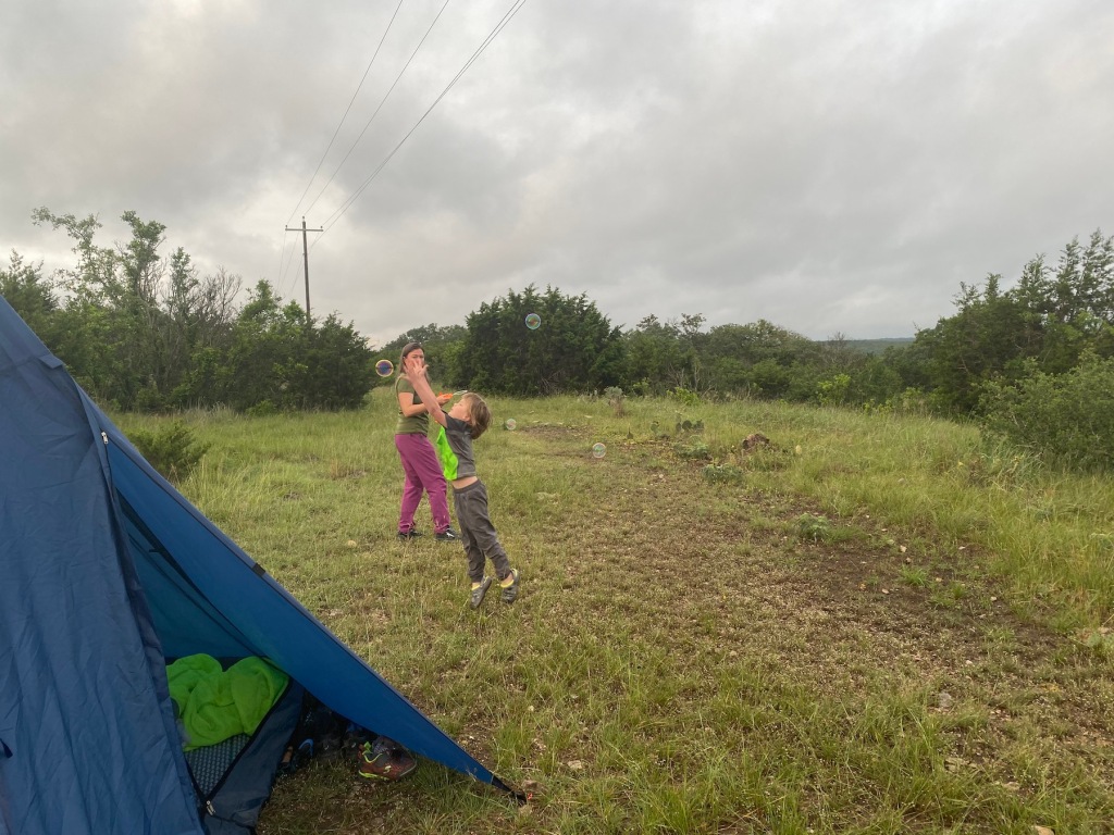
Our six-year-old carried a small backpack with a few items and did really well hiking 5.5 miles on day one, 3.6 miles on day two and 2.2 miles on day three. Hiking to the day use area is something almost anyone can do, as it is one mile each way, and you could bring enough water for that hike without filtering. If you plan to do any of the loops, it would be a good idea to have a water filter, as the amount of water you’d need to carry would be more weight than you’d likely want to haul around. And, of course, bring a can of OFF!, or your preferred brand of bug spray. Finally, know that when it says “steep” on the map, it is actually a steep section of trail that can be somewhat strenuous.

If you live near Lost Maples, plan a day trip soon. If you live a bit further away, grab a reservation for an RV site or primitive campsite. You’ll be glad you did because, while it is certainly beautiful in the fall based on photos I’ve seen, this weekend showed us that it is a wonderful place to explore year-round.
Note: Additional photos from the trip are available here.

Pingback: Lost Maples State Natural Area: November 2021 | Dawes Outdoors
Pingback: Lost Maples State Natural Area: New Year’s Weekend 2022-2023 | Dawes Outdoors