“Well, we are the most the popular park in the state, and we’ve been going full bore since we opened this morning.” That was the park ranger’s reply when I jokingly said that we learned not to arrive around 2 p.m. to enter the park.


Excited by a few glimpses of the canyon along State Highway 217 that leads into Palo Duro Canyon State Park (PDCSP), our enthusiasm quickly dimmed when the flow of traffic came to standstill. We were still a half-mile from the entrance, and it took another hour slowly inching forward to cover that distance. I’d recommend planning to arrive at or after 5 p.m. if you’re camping at PDCSP during spring break or holiday weekends.

The views of the canyon after finally passing through the park gates quickly took away any frustrations we had over the traffic. The winding park road into the canyon basin where the various camping areas are located offers fantastic views of the canyon, with multiple places to pull over and enjoy the scenery.


Our son wasn’t feeling 100% the morning of departure, so we found a campsite at Abilene State Park (ASP) to cover the roughly eight-hour total drive time over two days. ASP is a nice park with lots of campsites and several historic Civilian Conservation Corps structures, but it’s not a park we’d likely visit for its own sake. There aren’t many hiking trails, with the main attractions being Lake Abilene (you must exit the park and drive one mile up a road to access the lake) and a swimming pool. If you’re heading to PDCSP from Central Texas, then ASP is a good option for splitting the trip into a couple of days. On the trip home, we drove straight through, covering the 490 miles in 9.5 hours of travel time. While it went smoothly, the time and distance gave us firsthand insight into the opening line of “Amarillo by Morning” – and we didn’t even have to drive all the way from San Antonio.
TRIP OVERVIEW

We spent four nights at the park in mid-March, with temperatures ranging from the low-30s on a few nights to a high of around 80 degrees one afternoon. Other than a few very light sprinkles of rain one afternoon, it was clear and sunny and about as good of weather as you could hope for. Most days there was only a light breeze, with one day of significant wind that whipped up lots of dust and blew away anything not well secured. We ended up leaving a day early, since what would have been our final day had forecasts of significant wind all day, along with an increased chance of rain and the possibility of wintry mix due to sub-freezing overnight temperatures. Not wanting to deal with all these factors, we decided to quit while we were ahead on the weather front. Spring and fall would be my recommendation for ideal temperatures at PDCSP. Winter would likely be fine, though there is the likelihood of freezing temperatures each night and the possibility of snow and ice. A summer trip would likely be too warm for my taste, as there isn’t a great deal of tree cover at the campgrounds or on the trails to offer much shade.
PARK OVERVIEW

PDCSP is around 12 miles east of Canyon, Texas, and around 25 miles south and slightly east of Amarillo. In 1933, the State of Texas purchased the land that would become the state park, and Civilian Conservation Corp workers worked for five years to create the park, which opened in 1934 as a work-in-progress. A brief history is available here. At 120 miles long, 20 miles wide and with depths up to 800 feet, it is the second largest canyon in the United States. Information about the geology and natural life in the canyon is available here. In addition to the 30 miles of mixed-use trails, in the summer, there is a musical performance on Tuesdays through Sundays at the outdoor Pioneer Amphitheater near the Sagebrush Camp Area. A park map is available here, and a trails map is available here.
CAMPGROUNDS

We stayed at site no. 134 at the Sagebrush Camp Area, which is the first campground you come to after descending into the canyon. Rocky Mountain Juniper trees (from which the park derives its name) and other trees of similar height are on either side of the site, which has a covered pavilion, a beautiful view of the canyon cliffs and it is close to the bathroom. Sagebrush sites have electricity (30- and 50-amp hookups) and water. Whenever we’re able to visit again, we’d likely try to reserve this same site. That said, it looked like all the campgrounds offer nice views of the canyon walls, and each offer access to different trails, so I don’t think you can really pick a “bad” camping area or site.


There are five other camp areas, as seen on the map above. Juniper, Mesquite and Wolfberry all offer 30- and 50-amp hookups plus water, while Hackberry has only 30-amp hookups with water. All the developed camp areas have a bathroom facility with showers. Fortress Cliff is a tent-only primitive camping area that has a water spigot and a port-o-potty.

The other camping options are the three Rim Cabins (which have a bathroom inside) located near the visitor center / store before you descend into the canyon and the Cow Cabins (seen above), which do not have a bathroom inside and are located in the canyon basin near the Mesquite Camp Area. The Rim Cabins are very popular, so they can be difficult to reserve. Finally, there is a relatively recent “glamping” option, which you can learn more about here.
TRAILS

The trails were the star of the park for me. Of course, you can certainly enjoy PDCSP without hiking any of the trails, as the overlook near the visitor’s center offers a fantastic view of the canyon and driving around the park road through the middle of the canyon offers beautiful views as well. And there are several short and easy trails that even those who don’t want to do any strenuous hiking would enjoy.


Collectively, our family completed all but five trails – and of these five, one is equestrian only and another is mountain bike only. My wife and I estimated that we both hiked / jogged around 25 miles each. As seen above, PDCSP’s trails are a combination of dirt (often reddish orange) and rock, with several of them being easy and family friendly. Without being shuttled to and from trailheads, you need to do a lot of out-and-back hikes or put together longer loops that might involve some road walking. One challenge of the trails is that there are so many well-traveled off-shoots to the main / official trails that it can be hard to know which way to go, even though the trails are marked every 0.1 miles. Getting lost is not a major concern in most cases, but it can be frustrating to take the wrong path and then need to turn back to find the main trail. Having a GPS and/or a trails app (like Garmin Earthmate, Gaia GPS or All Trails) is quite helpful at PDCSP to ensure you’re taking the main path. And if you’ve hiked for 0.1 miles or so without seeing a trail marker, then you’ll know to turn back to the intersection and take the other path.

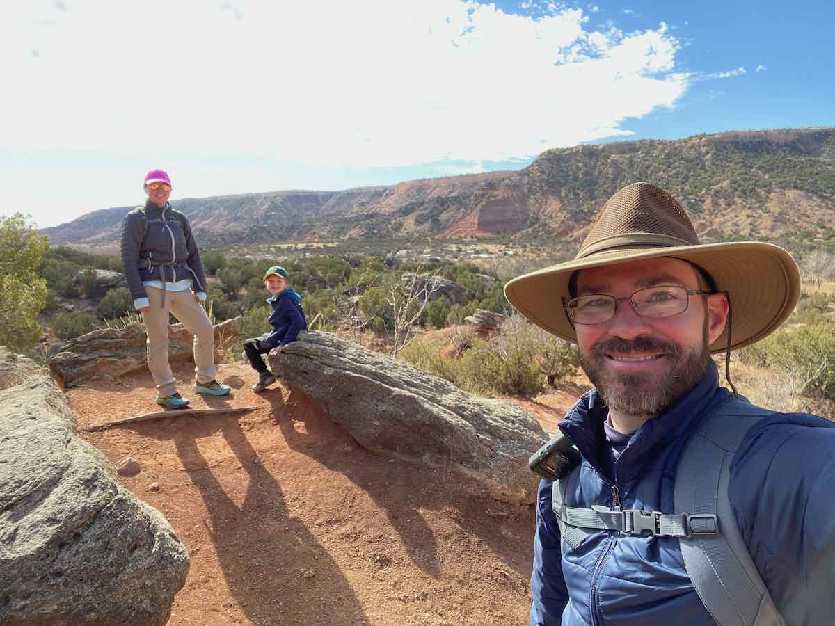
Our son (who was a few weeks from turning seven on this trip) is typically a good hiker, but he was still recovering from a 24-hour stomach bug a few days prior to leaving, so he wasn’t up for hikes much longer than 2-4 miles at a time. So, we kept our family hikes on the shorter side, and my wife and I took turns hiking on our own. We shuttled each other to various trailheads, which allowed us to hike more trails without having to do a lot of out-and-back hikes (other than the trails that require it, of course). What follows is a brief description of the trails we hiked, along with a few photos of each.
The Lighthouse Trail


This is the most popular trail in the park, so go early to avoid the crowds and the heat. It is an out-and-back hike that takes you to the iconic rock formation (known as a “hoodoo”) for which PDCSP is known. The trail is mostly flat and easy to hike, but there is very little shade – so wear sunscreen and a hat and bring plenty of water. When you reach a clearing with a bike rack, the main path is to the left, involving a steep climb through a rocky section to reach the hoodoo. An unofficial trail to the right also leads up to the top, and it is significantly easier. While I would hike the Lighthouse trail again, I’d suggest starting at the trailhead for Givens, Spicer, Lowry Trail (near the Hackberry Camp Area), as it intersects with the Lighthouse Trail about a mile from the hoodoo. My wife hiked this trail on the way back (more on this below) and said it was more pleasant than the first portion of the Lighthouse Trail.
Givens, Spicer, Lowry Trail


This trail begins at a parking area near the Hackberry Camp Area and ends at the Lighthouse Trail – it is also the only means of accessing the Little Fox Canyon Trail (which we didn’t hike on this trip). On our way back from the hoodoo at the end of the Lighthouse Trail, my wife took a left on the Givens, Spicer, Lowry Trail, while my son and I continued back to our car on the Lighthouse Trail and drove to pick her up. She enjoyed this trail much more than the Lighthouse Trail, as there were several ascents and descents, as well as a greater variety of views along with more twists and turns, and fewer people. However, there aren’t any rest areas with benches (like there are on the Lighthouse Trail) and there isn’t any more shade than on the Lighthouse Trail. Also, at 3.1 miles it is a longer distance to cover than staying on the Lighthouse Trail the entire time. So, while we’d recommend this as a better option to go see the hoodoo for which PDCSP is well-known, the Lighthouse Trail is the easier and more family friendly option.
Rock Garden Trail


Our family hiked this trail up to where it intersects with the Lower Comanche Trail. You’re ascending most of the time, save for a brief section where it is somewhat flat. As the name suggests, there are interesting rocks of various shapes and sizes throughout the trail, and it offers beautiful views of the canyon. I hiked the upper portion by myself later, finding it to be a more challenging section since it is all uphill – though your efforts are rewarded with continued views of the canyon. This trail is also the only way to access the Rylander Fortress Cliff Trail, which I didn’t hike – though I did hike about 0.25 miles to an overlook on what I later realized was unofficial trail. On our next visit, I plan to hike the Rylander trail and the various spurs that offer views of the canyon from different vantage points.
Upper Comanche and Lower Comanche Trails


I strung together a series of trails one afternoon to complete all of the Upper Comanche Trail and much of the Lower Comanche Trail. I began by taking part of the Kiowa Trail from our Sagebrush campsite to the Upper Comanche trailhead, hiking the Upper Comanche Trail, and then continuing on the Lower Comanche Trail to the Rock Garden Trail intersection, at which point I hiked the upper part of this trail (as noted above). You can take the Soapberry Spur to a bathroom / parking area if you only want to do the Upper Comanche and someone can pick you up. I had planned to finish the Lower Comanche Trail after descending from the top of the Rock Garden Trail, but it was near dinner time when I arrived back at the intersection, so I continued down to the Rock Garden trailhead where my wife and son picked me up. This was probably my favorite hike, as it offered closeup views of the rock formations, beautiful views of the canyon throughout, along with a good bit of solitude. I’d recommend this hike to anyone interested in a longer hike (the total distance was around 10 miles) with some easy sections (the Upper Comanche) and some more challenging sections (Lower Comanche and Rock Garden). On our next visit, I’d likely repeat this hike, but I’d plan enough time to finish the last 1.9 miles of Lower Comanche (which I never did on this trip).
CCC Trail – Triassic Trail – Goodnight Peak Scenic Loop


The CCC Trail is another hike I really enjoyed, both for the challenge (it seemed like the most strenuous of the trails at PDCSP if you hike it from bottom to top) and for the canyon views. The trailhead at the top is near the visitor’s center, while the trailhead at the bottom is in the parking lot next to the amphitheater. You’re ascending the entire way via switchbacks until you reach the Goodnight Peak Scenic Loop, and then you have a more level section until the last half-mile or so, at which point the trail climbs up to the overlook at the visitor’s center. There are certainly a number of steep sections and several places where there are significant drop-offs near the trail, so those with younger children might want to skip this hike. For those wanting to enjoy the canyon views without the climb or descent of the CCC Trail, park at the trailhead for the Triassic Trail right off the park road, and you’ll have a short, easy, and mostly flat hike out to an overlook.
Juniper / Riverside Trail – Sunflower Trail – Rojo Grande Trail – Paseo del Rio Trail – Kiowa Trail


These trails run in between and/or alongside of the park road. They can be done one at a time as out-and-back hikes, but my wife and I each strung them together to make one long hike by shuttling each other to the Juniper / Riverside trailhead near the Equestrian Camp Area and then taking the combination of trails back to our campsite at the Sagebrush Camp Area. The total combined length of the five trails is around 6 miles, which I hiked one evening after dinner and my wife did a trail run one morning. You enjoy views of the canyon walls in the distance on both sides of the trail, cross over and walk / run alongside the Prairie Dog Town Fork of the Red River several times, enjoy a few sections where there is an actual tree canopy and pass by several sections with the red-orange-brown rocks found throughout the park. This is a perfect set of trails for families, as they are mostly flat (you are ascending throughout but gradually) and can be done all together or in sections. There are also picnic areas every so often, and you’re close to the road the entire way if you needed help. They are great for hiking, trail running and mountain biking, and they provide the most shade of any trails in the park.
Pioneer Nature Trail


This is the perfect hike for families with younger children. While my wife was running on the park road from our campsite down to the Equestrian Camp Area and back (a roughly nine-mile loop), my son and I hiked the Pioneer Nature Trail. It’s short (0.4 miles) and mostly flat, with an offshoot trail you can take to view the Prairie Dog Town Fork of the Red River as it flows through the park (as noted above, many of the unofficial trails are as well-worn as the official trails, so we took one offshoot to before realizing we’d left the main trail). This is one of the few trails that is a loop, so you’ll start and end at the parking lot by the trailhead.
The Big Cave


This is not an official trail, but is a “point of interest” on the trails map. You park on the side of the road, and then walk a few hundred yards across the red-orange dirt to view and explore the cave and surrounding area. It is a flat walk with a chance to climb on some boulders as you make the brief ascent into the cave. Our son really enjoyed this, and I’d recommend this for a quick, easy, and family-friendly option.

This was a fantastic spring break trip for our family, and I’d highly recommend that you consider planning a trip to PDCSP in the spring or fall.
**Image file sizes have been significantly reduced to improve page loading time. As such, some may appear slightly pixelated when enlarged.

Love these pictures. I’m hopeful to go back one day and re read your great suggestions. So glad y’all had a great time!
LikeLike
Thanks, Heather! Yes, it is a beautiful area, and I hope y’all are able to go back when the weather is more cooperative for you.
LikeLike
Pingback: Family Vacation: Avon/Vail, Colorado – June 2022 | Dawes Outdoors
Pingback: Looking Back During a Hot and Dry Summer | Dawes Outdoors